top of page
Create Your First Project
Start adding your projects to your portfolio. Click on "Manage Projects" to get started
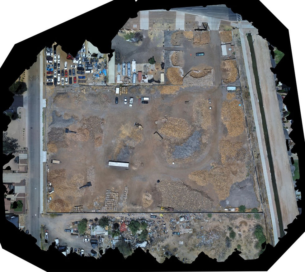
Arizona - Paul Bunyan's Firewood
Project type
Mapping / Modeling / Photogrammetry
Date
May 2024
Role
Remote Pilot In Command (RPIC) / Visual Observer (VO)
Coordinate System
NAD27 / EPSG: 26749
Orthomosaic Resolution
0.3 in/px
Accuracy
RMSE = 3.2ft / X = 2.1ft / Y = 2.1ft / Z = 4.8ft
Aircraft
Parrot Anafi USA
Following the creation of the orthomosaic model, photogrammetry was implemented to estimate inventory in the stockyard. This map was also utilized to assist in identifying areas of concern.


bottom of page


